Imagine stepping from your back porch onto your boat, easing down the Tchefuncte River, then opening up to Lake Pontchartrain in minutes. If that vision draws you, Madisonville delivers a rare blend of relaxed river life, quick lake access, and easy ties to Greater New Orleans. You want the fun and the finesse: where to dock, how the bridge works, what homes look like, what flood insurance means, and how the market behaves. This guide gives you the essentials so you can buy with confidence. Let’s dive in.
Madisonville on the Tchefuncte
Madisonville sits on the north bank of the Tchefuncte River where it meets Lake Pontchartrain. It is about 38 miles by road from New Orleans, with typical drive times ranging from roughly 35 to 60 minutes depending on traffic and route according to Travelmath. For many buyers, that makes weekend or frequent trips to the city very manageable.
The town’s rhythm follows the water. Annual highlights include the Wooden Boat Festival, which benefits Maritime Museum Louisiana and fills the riverfront with classic vessels and local flavor as detailed by the museum. The Krewe of Tchefuncte boat parade during Mardi Gras season is another beloved tradition. If you value a boating-forward lifestyle with a strong sense of place, Madisonville is a standout on the Northshore.
Boating access and marinas
Fast run to Lake Pontchartrain
If quick lake access is a priority, location on the river matters. Marina del Ray is the area’s largest full-service marina and is positioned below the Madisonville bridge, which shortens time to open water. It offers covered and transient slips, a launch, and dry storage, and markets its fast connection to Lake Pontchartrain. Check current slip availability and services directly with Marina del Ray.
Public launch options
You will also find a public boat ramp in Madisonville, commonly referenced at 2001 Main Street. Local resources note that it puts you on the Tchefuncte just minutes from the lake. Confirm parking, hours, and any permits in advance. For reference, see the Madisonville boat launch listing.
Bridge clearance and timing
The LA 22 bridge crossing the river in Madisonville is a swing bridge. Reported closed vertical clearance is low at approximately 6.2 feet above mean high water in the closed position, and the bridge opens for vessel traffic under federal drawbridge rules. Plan passages for taller vessels around openings, and confirm current operating procedures or any temporary deviations through federal notices. For context on drawbridge operations, see the Federal Register’s drawbridge notices.
Waterfront homes and features
Styles and settings
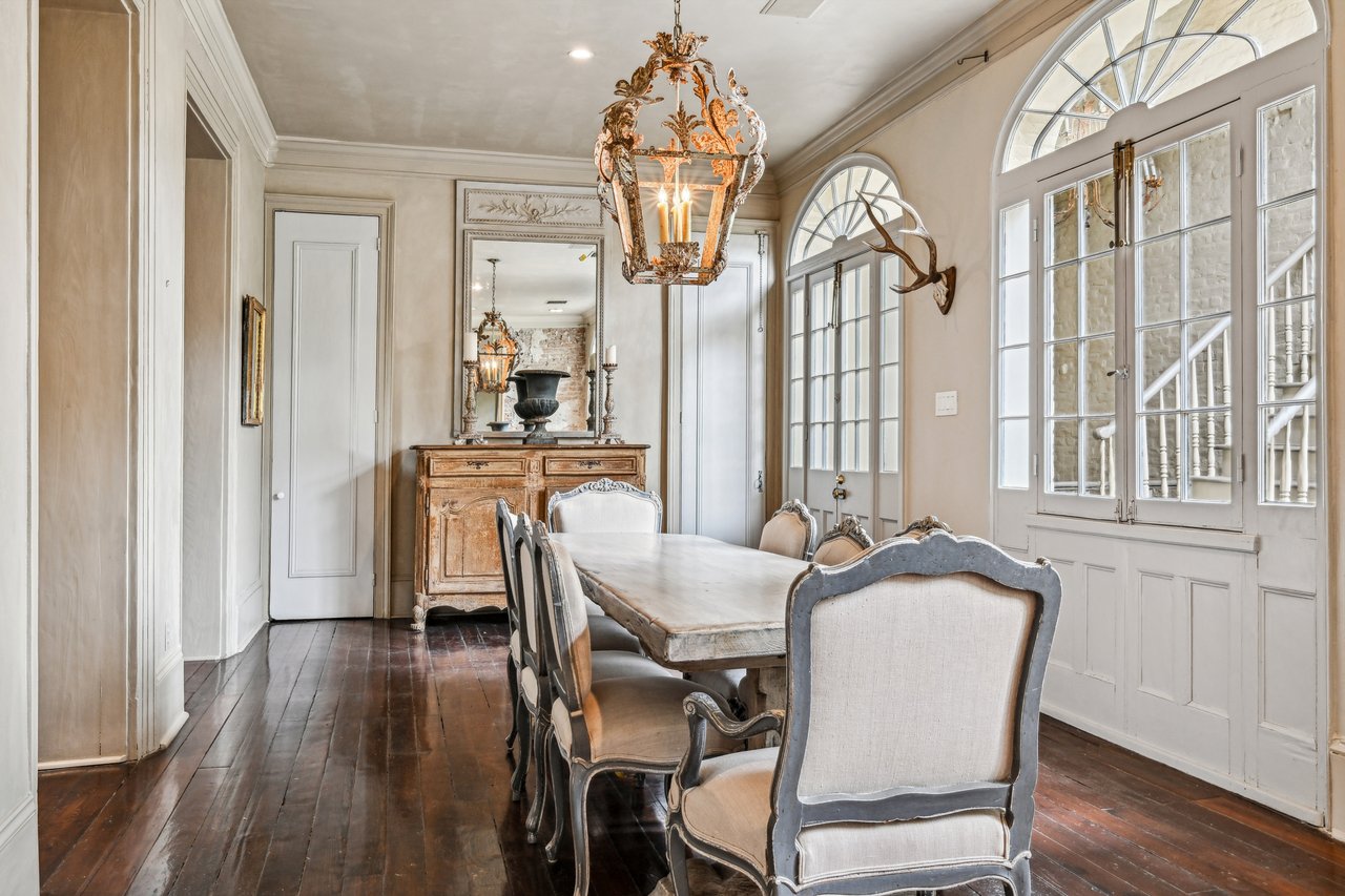
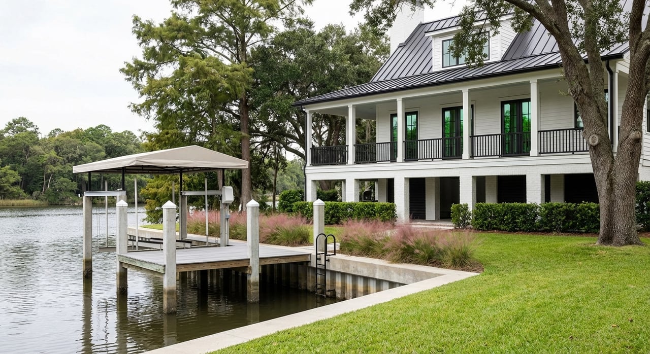
You will encounter a range of property types along the Tchefuncte. Historic cottages and estate-style homes reflect the area’s heritage, with nearby Fairview‑Riverside State Park and the Otis House offering a window into late 19th-century architecture and local history via the park’s overview. South of the bridge and along primary channels, custom single-family homes and estate properties often sit on deeper water and feature boat lifts, multi-slip boathouses, and expansive outdoor living.
Entry-level waterfront ownership commonly includes condos or townhomes along LA 22 and in planned waterfront communities. These can provide private or shared slips and lower-maintenance ownership. Single-family riverfront homes tend to command a premium for usable water depth, protected shoreline, and turnkey dock infrastructure.
Docks, bulkheads and utilities
Most riverfront properties rely on shoreline protection such as engineered bulkheads, seawalls, or riprap. Ask for the age and condition of these systems and plan for inspections. Docks range from simple floating piers to covered boathouses with lifts. Listing details often include dock depth, slip length, and bulkhead type. For projects that touch the shoreline or water, permitting may involve parish authorities and federal regulators. The U.S. Army Corps of Engineers’ New Orleans District posts public notices for shoreline protection and related work, which can affect navigation and local conditions. Review examples and updates through USACE public notices.
Many high-end builds include resilience features such as elevated utilities, whole‑house generators, and thoughtful drainage. In coastal settings, pile or pier foundations and breakaway walls may apply to new builds or substantial improvements depending on flood zone and code requirements. Work with qualified professionals who understand the local code and coastal standards.
Pricing and market behavior
Waterfront property in Madisonville trades at a premium compared to the broader town median for all property types. As a general orientation:
- Entry-level waterfront, often condos or townhomes with shared or small private slips, typically starts in the low-to-mid six figures.
- Mid-range single-family waterfront homes with private docks often trade in the roughly $600,000 to $1.25 million range depending on depth, frontage, and condition.
- Luxury riverfront estates with deeper water, multi-slip boathouses, and extensive outdoor amenities can list from about $1.2 million into the multi-million range.
Inventory is tight, with many properties held long term and demand rising in spring and early summer. Buyers often pay premiums for proven depth, superior bulkhead condition, and move-in-ready docking. Review recent comparable sales and days-on-market with your agent before making offers.
Flood risk and insurance
Map your flood zone
Always confirm a property’s flood zone designation and Base Flood Elevation through FEMA’s Flood Map Service Center. Pull a FIRMette for the parcel and request any available Elevation Certificate from the seller or prior insurer. Start here: FEMA Flood Map Service Center.
If you use a federally regulated lender and the property lies in a Special Flood Hazard Area, flood insurance will be required. Even outside mapped high-risk zones, many riverfront owners choose to carry coverage for added protection.
How Risk Rating 2.0 works
FEMA’s Risk Rating 2.0 sets National Flood Insurance Program premiums at the property level. Factors include elevation, distance to water, replacement cost, and local flood frequency. Homes closer to open water or with higher replacement values often see higher premiums than similar homes farther from the channel. Learn more from FEMA’s guidance on Risk Rating 2.0.
Quotes and mitigation tips
Get quotes early. Request an Elevation Certificate, seek both NFIP and private-market quotes, and ask about mitigation credits and any Community Rating System discounts. If you are new to flood insurance, the NFIP’s overview for agents explains the basics of eligibility and requirements in a consumer-friendly way. See the background information from Floodsmart. For a deeper look at how elevation data supports pricing and discounts, review this practitioner explainer on elevation certificates and Risk Rating 2.0 from American Surveyor.
Permits and shoreline projects
Who regulates what
Docks, boathouses, bulkheads, and bank stabilization in navigable waters often require coordination with multiple agencies. The U.S. Army Corps of Engineers regulates many in-water and shoreline activities, and St. Tammany Parish will have its own building and development requirements. Before you buy or build, review the Corps’ regulatory resources and be ready to reference permit numbers or drawings if improvements already exist. Start with the USACE New Orleans District Regulatory page.
Plan for maintenance
Bulkheads and docks have service lives. Budget for inspection and periodic repairs, and obtain bids from qualified marine contractors. Modest repair scopes can be a five-figure line item over time, so a multi-year maintenance plan is smart. Monitor USACE public notices for projects that may alter local shoreline or navigation conditions. See a recent USACE notice example for context on protection work at the river’s mouth.
Buyer checklist
Use this quick list to focus your due diligence:
- Confirm usable water depth at the dock or slip at mean low tide and ask if dredging has been done recently.
- Verify permits for existing docks, boathouses, and bulkheads. Request drawings and any prior permit numbers, then confirm with the parish and USACE if needed.
- Request an Elevation Certificate and gather flood insurance quotes from NFIP and private carriers early in the process.
- Inspect bulkhead and dock condition with a marine contractor. Get repair or replacement bids and build a multi-year maintenance plan.
- Review marina and community rules for moorage, guest slips, and launch access. Check current slip availability with Marina del Ray if you need additional capacity.
- Test-drive real commute times to New Orleans and nearby business hubs to confirm your weekday routine works.
Madisonville lifestyle highlights
Life on the Tchefuncte blends daily ease with seasonal energy. The Wooden Boat Festival brings heritage craft to the river each fall, and the Krewe of Tchefuncte sets a festive tone during Mardi Gras season. Nearby Fairview‑Riverside State Park offers trails, picnic spots, and a serene riverfront setting outlined by the park system. Dining, small-town amenities, and a strong boating culture round out a lifestyle that feels both relaxed and refined.
If you are considering a move to the river, thoughtful preparation goes a long way. Prioritize dock depth, bulkhead condition, flood mapping, and insurance quotes early, then align property features with how you actually boat on the Tchefuncte and the lake.
Ready to explore Madisonville waterfront living with a team that knows the river, the marinas, and the nuances of coastal construction and insurance? Connect with Jennifer Rice for tailored guidance and a private look at on- and off-market opportunities.
FAQs
What should boaters know about the Madisonville bridge clearance on the Tchefuncte?
- The LA 22 swing bridge has a low closed clearance of about 6.2 feet above mean high water and opens under federal drawbridge rules, so plan passages and confirm current operations via official notices like the Federal Register.
How long does it take by boat from Madisonville riverfront homes to Lake Pontchartrain?
- Properties below the bridge can be on the lake in just a few minutes, while upriver coves may take roughly 10 minutes or more depending on location and no-wake zones.
Where can I check a Madisonville property’s flood zone before I make an offer?
- Use FEMA’s Flood Map Service Center to pull the property’s FIRMette and confirm Base Flood Elevation, then request an Elevation Certificate from the seller if available: FEMA Map Center.
How does FEMA’s Risk Rating 2.0 affect flood insurance costs for riverfront homes?
- NFIP premiums are now set at the property level based on factors like elevation, distance to water, and replacement cost, so closer-in, higher-value riverfront homes often carry higher rates per FEMA guidance.
If my property lacks a private ramp, where can I launch a boat in Madisonville?
- The public ramp at or near 2001 Main Street provides convenient river access; review parking, hours, and any permits in advance via the Madisonville boat launch listing.